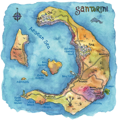
Santorini has a very unusual shape when seen from above and that’s because the island is actually a volcano. In 1,600 BC, the volcano erupted and then collapsed, taking most of the island with it, leaving behind the current five islands. The ancient city of Akrotiri was also lost. Many people speculate that this island is where the lost civilization of atlantis was located. Regardless of whether it was or not, this is a beautiful place to visit. Boat tours can also be taken out to the center island to see its smokey center. This map shows the different places we visited as we drove around the island in our tiny car.
